The pyramid had already been published when Pietro Miotti said that 48 artificial intelligence agents had located an unknown Maya site in NASA lidar data. On November 11, the researcher corrected the account: the site appears in a 2025 archaeological study. The agents flagged it in the images, but failed to check whether anyone had documented it before.
The search, conducted in October, did find a structure that did not appear in the records of Mexico’s National Institute of Anthropology and History (INAH). The institution’s response, however, only confirmed that it had no archaeological site registered there; it did not prove that the place was unknown to the scientific community. That distinction turned a promising detection into an exaggerated discovery claim.
Miotti described the work on his blog as a three-day sequence: from an idea that came to him during a trip to an official response from INAH. The later update preserves the discovery in the images and the contact with the institution, but changes its novelty: other archaeologists had mapped the site before.
From an idea during a trip to 1,200 km² of lidar
The story began on October 18, when Miotti was traveling in Peru and asking Gemini about the area’s history. While reading about Hiram Bingham and his arrival at Machu Picchu, he wondered what the explorer might have done with today’s tools. Bingham was searching for Vilcabamba, the Incas’ last refuge, when a local farmer guided him to the ruins, according to Miotti’s account.
Miotti spoke with several agents—Gemini, ChatGPT, Claude, and Grok—and they suggested using lidar. Satellite photographs may mainly show the vegetation canopy; lidar, by contrast, uses laser pulses that pass through gaps between the treetops and make it possible to map the ground beneath the vegetation. The public lidar coverage in Peru was not useful for the project, so he shifted the focus to the Maya region, where he found more data available.
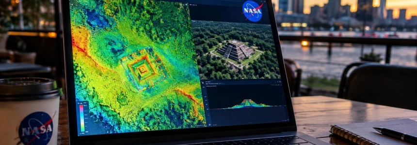
That night, he let the agents analyze the images. The next day, he received alerts about numerous settlements and regular shapes that could correspond to structures. The system processed lidar strips covering about 1,200 km² of jungle and converted them into images. Then 48 agents reviewed them one by one using a guide that asked them to look for pyramids, platforms, and plazas, and to rule out natural hills, sinkholes, and roads.
No special model or classifier was used: the agents examined the images by following a precise guide.
After the first round, he asked them to check which of the candidate settlements had not been discovered, searching the literature and archives. The selection settled on a rise beside the edge of a cliff, covered by jungle and marked by straight edges and sharp corners.
A plaza, an oval pyramid, and a possible reservoir
In the processed relief, Miotti identified a level plaza and an oval pyramid at least 8 to 12 meters high. Beside it was a raised courtyard and a flat-bottomed depression that might have been a water reservoir. Three platforms were also visible which, according to the initial interpretation, could have been dwellings.
Before submitting the discovery, the agents reviewed the raw lidar point cloud to check that the shapes were on the ground and not an effect of the trees. In two cross-sections of the data, the ground beneath 10 to 17 meters of forest outlined the plaza, pyramid, and courtyard. Miotti presented this check as a way to verify that the outline did not come from the vegetation.
The researcher asked the agents what he should do. They recommended contacting INAH, preparing a report, and finding out whether the site appeared in its records, bearing in mind that the institution might have unpublished results. The agents also gave him instructions for drafting the document and email addresses. Miotti reviewed the text, translated it into Spanish with Claude’s help—he said he does not speak Spanish—and sent it on October 20. The exact coordinates were included in a confidential appendix.
INAH replied on October 21 that it had not identified a registered archaeological site at the specified location. Miotti then understood that no one had mapped the place. That conclusion was unfounded: the response referred to the institute’s records, not to the entire archaeological literature.
The 2025 publication the search overlooked
In his November 11 update, Miotti explained that the site had already appeared in a paper by Estrada-Belli and other authors published in 2025. Miotti’s post cites the study among its references, under the title “New regional-scale Classic Maya population density estimates and settlement distribution models through airborne lidar scanning.”
Sysnote specifies that the article, authored by Francisco Estrada-Belli, Marcello A. Canuto, Ivan Šprajc, and Juan Carlos Fernandez-Diaz, appeared in volume 66 of Journal of Archaeological Science: Reports in October 2025, with article number 105288. According to the publication, the study used public and commercial lidar, including reprocessed environmental data from southern Campeche and southern Quintana Roo, to model settlements across an area of 95,000 km² in the Maya Central Lowlands. Sysnote identifies the site’s location on page 14.
The reference was therefore among the recommended readings in Miotti’s own text, although it was described as a study of population estimates in the Maya Lowlands. The problem was not only that the agents failed to find it: their novelty check accepted as unpublished a location that already appeared on the study’s map.
Miotti summed up the correction this way:
The agents missed it, I missed it, and it wasn't in INAH's register yet.
— Pietro Miotti, Google researcher
The initial version circulated as a discovery made in 72 hours. The Verge reported that archaeologist Sarah Parcak noted on Bluesky that Francisco Estrada-Belli, of Tulane, had published the site years earlier; Miotti’s update specifies that it appears in the 2025 study. TechRadar described the place as a Maya site that did not appear in the scientific literature and noted that experts were investigating it.
What remains and who is continuing work on the site
The correction does not invalidate the fact that the agents flagged a structure visible in the data. Miotti himself wrote that the rest of the account still held: a system of 48 agents identified a configuration that archaeologists had already mapped using lidar. What failed was the check that it was a new discovery.
Miotti’s archaeological interpretation was provisional. Based on an extensive conversation with the agents, he described the complex as a possible Maya civic center from the Classic period, approximately between 250 and 900 CE. The plaza may have served for gatherings, ceremonies, or perhaps a market; the pyramid may have been a temple, and the raised courtyard the residence of a local authority. The depression might have been a reservoir for collecting rainwater, although Miotti also left open the possibility that it was simply a hole. The three platforms may have been houses.
Miotti asked Gemini to create an image of what the place might have looked like around the year 700, based on the distribution observed in the lidar. This reconstruction does not add verification of the buildings’ use: the function of the structures remains an interpretation of the landforms, not a conclusion confirmed through fieldwork.
Miotti noted that the site is now in the hands of INAH and the archaeologists who mapped it first. He said he would post an update if anything new emerged. His post also cites earlier work on NASA’s G-LiHT instrument, the archaeological reuse of environmental lidar, the discovery of a Maya city in Mexico in 2024, and studies of Maya settlements and possible markets.
The clearest evidence from the episode is not that the agents discovered a previously unknown pyramid, but that they located a structure in images that had already been documented. The same sequence exposed the process’s specific limitation: moving from recognizing shapes in large volumes of data to verifying their novelty required reading a reference that was on the project’s own reading list.
Sources: Pietro Miotti, The Verge, TechRadar, sysnote